Early Writings
The Fifteenth Century
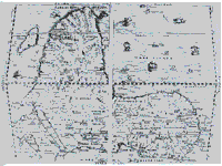
If we want to find out about the written sources and the early history of the wider region, we have to refer to Lange’s work. His translation of Arabic scripts, especially ‘Le Diwan’ (1977), descri- bes how the geographical centre of power was moved in the 12th century from Kanem at the east to Bornu at the southwest of the Lake. The kings of Kanem and Bornu claim to descend from ‘Saif’’ who once come from Arabia.
The royal chronicles of the ‘Sefuwa’, which was probably begun in the thirteenth century and updated until the 1800s, mention in the fourteenth century, the Sao (ibid). The Sao are ancient non- Islamic peoples of south and east of Lake Chad. They began to disintegrate in the 16th century. The Sao formed a confederation of towns with a perimeter wall. They had a centralised sytem with kings and dignitaries (see Lebeuf and Forkl).
The Sixteenth Century
Lange’s ‘A Sudanic Chronicle’ (1987) translates Ibn Furtu’s text about the Borno expeditions of Idris Alauma between 1564 and 1576. The chronicles are of great historical importance because they give evidence of the Wandala coming increasingly under Bornu’s influence. The account verfies Kerawa as the original capital of the Mandara. Also the Gamergu, the Margi and the Sao are mentioned in this Arabic text.
Leo Africanus, a christianized Moor, describes1526 (published 1896) Bornu and its rulers and the sourrounding lands. It must remain unclear whether he refers to the Northern Mandaras when he speaks disapprovingly of the ‘nakedness’ and ‘brutish manner’ of montagnards. Leo Africanus records that Bornu rulers exchange slaves for horses. This is confirmed by Giovanni Lorenzo Anania (1582), who speaks in addition of the economic significance of the iron trade (Lange 1972).
Seventeenth to Nineteenth Century
There are less written sources available for the 17th and for the 18th century. The important internal source are the ‘Chronicles of Wandala’ (Mohammadou 1982). They deal mainly with the history of Wandala during the 19th century, but also speak of earlier links with the Mulgwe (Gamergu). Founded in the 13th century, Wandala expands during the 17th century southwards, alongside the Northern Mandaras.
Forkl (1995) sets the date of the Islamisation of Wandala at 1723. Major Denham visits1823 Mora. The derogative name Kirdi, a Kanuri word for the montagnards is first mentioned by him. Another derogative ethnic synonym is Wula, which is presumably a Mandara word. Rabeh (Oppenheim 1902), who had his headquarters in Dikwa, destroyed the then Wandala capital Dulo (not far from Mora) in 1894.
The power of the Wandala state began to decline with the arrival of the Fulbe of Sokoto who attacked its southern borders from the beginning of the 19th century onwards. Important sources are Strumpell’s ‘Geschichte Adamauas’ and the writings of the historian Mohammadou. The derogative name ‘Matakam’ for the Mafa came into use with the Fulbe arriving at the plateau of Mokolo around 1850 (Lavergne 1944).